
Date
no date set yet
Journey there
| Dep. Garching | 07:38 | (via Marienplatz, arrives Bhf 08:09) |
| Dep. Ismaning | 07:36 | (arrives Bhf 08:03) |
| Meet Hauptbahnhof | 08:15 | (meet before under departure board by platforms 25-26, after on train) |
| Dep. Hauptbahnhof | 08:32 | |
| Arr. Garmisch | 09:56 |
Hike start point
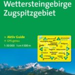
Hike map
![]()
Hike map in other formats
![]()
Hike description
- Leave Garmisch-Partenkirchen Bahnhof (708m) via the back of the subway that connects the platforms turning right onto Olympiastrasse.
- At the first crossroads, turn left onto Sankt-Martin-Strasse.
- At the second crossroads, turn right into Klammstrasse.
- Continue on Klammstrasse passing Höllentalstrasse, Klammstrasse, Am Kurpark to where the name of the road changes to Fürstenstrasse.
- If it is possible to continue on the same road then do so, crossing Allestrasse, crossing Loisachstrasse, passing Im Winkel on the right and at the end of Fürstenstrasse turn left.
- If it is not possible to continue on the same road then continue on the B23 road, passing Loisachstrasse on the left, Im Winjel on the left, Fürstenstrasse on the left.
- Continue past the AGIP petrol station, past Schussangerweg on the left and at the next left turn Thomas Knorr Strasse should be the start of the K5/KR/256/262 path.
- Follow the path going up Grasberg for 5Km to Sankt Martin Hütte (1028m).
- Continue weaving backwards and forwards on the 255 path in direction Kramerspitz to Schwarze Wang where the path forks (c.1450m).
- Take the left west fork and continue for 1Km to reach the 255/KR3/Kramersteig ridge path (c.1760m).
- Follow the ridge path south-west for 2Km to Kramerspitz (1982m).
- Follow the level ridge path west for 1.5Km and then for a further 1.5Km as it descends to Stepbergalm (1583m).
- To visit Hirschbühel continue west on the KR4/255 path for 500m to the Diensthütte and then turn right north-west onto the KR6 path. Continue on this path for 2Km to the gipfel (1935m) and then return to Stepbergalm.
- To visit Hoher Ziegspitz continue west on the KR4/255 path for 1Km and then turn left south (not the turning only 200m after the Diensthütte; there is a better one about 300m further). Continue on this path for 2Km to the gipfel (1864m) and then return to Stepbergalm.
- Walk east 100m along the 255/KR3 path back to Kramerspitz and to 259/Stepberg-Alpensteig Kreuzweg turning on the right.
- Take this right turning south and descend over 6Km to Almhütte (c.775m).
- Then try to head north-east on the KR/Waldlehrpfad path for 2Km to where the path crosses the K5 path (c.800m).
- Turn right onto the K5 gravel path which brings you back to Thomas-Knorr-Strasse and eventually back to Garmisch-Partenkirchen Bahnhof (708m).
Hike end point
Afterwards
We’ll eat at Zum Wildschütz. From the south-west side of the main railway line, it is a few blocks away at Bankgasse 9. (Please try to make it for the meal – it’s the best part of the day!)
Journey back
| Dep. Garmisch-Partenkirchen | 17:04 | 18:04 | 19:04 | 20:04 | 21:04 | 22:04 | 23:04 |
| Arr. Hauptbahnhof | 18:27 | 19:27 | 20:27 | 21:27 | 22:27 | 23:27 | 00:27 |
Photos
no photos taken yet
Important stuff
- If you want to share a group ticket let me know!
- You should definitely check the weather!
- For my peace of mind, some conditions apply!